地図 ジムサル県
 1871|SHAW, Robert Barkley.
 1833|Mahlmann, H.1:6 400 000
 18741:8 500 000
 1851|MARTIN, Robert Montgomery.
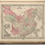 1866|Colton, G.W.1:10 000 000
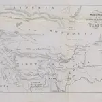 1851|Prinsep, Henry Thoby
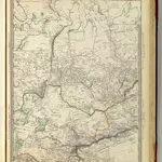 1838|Society for the Diffusion of Useful Knowledge (Great Britain)1:10 060 000
ジムサル県の古地図
歴史的な地図でジムサル県の過去を発見する
ジムサル県の古地図
歴史的な地図でジムサル県の過去を発見する
を探している Google Maps APIの代替?